Transforming Infrastructure Decisions with AI, LiDAR & Advanced Analytics
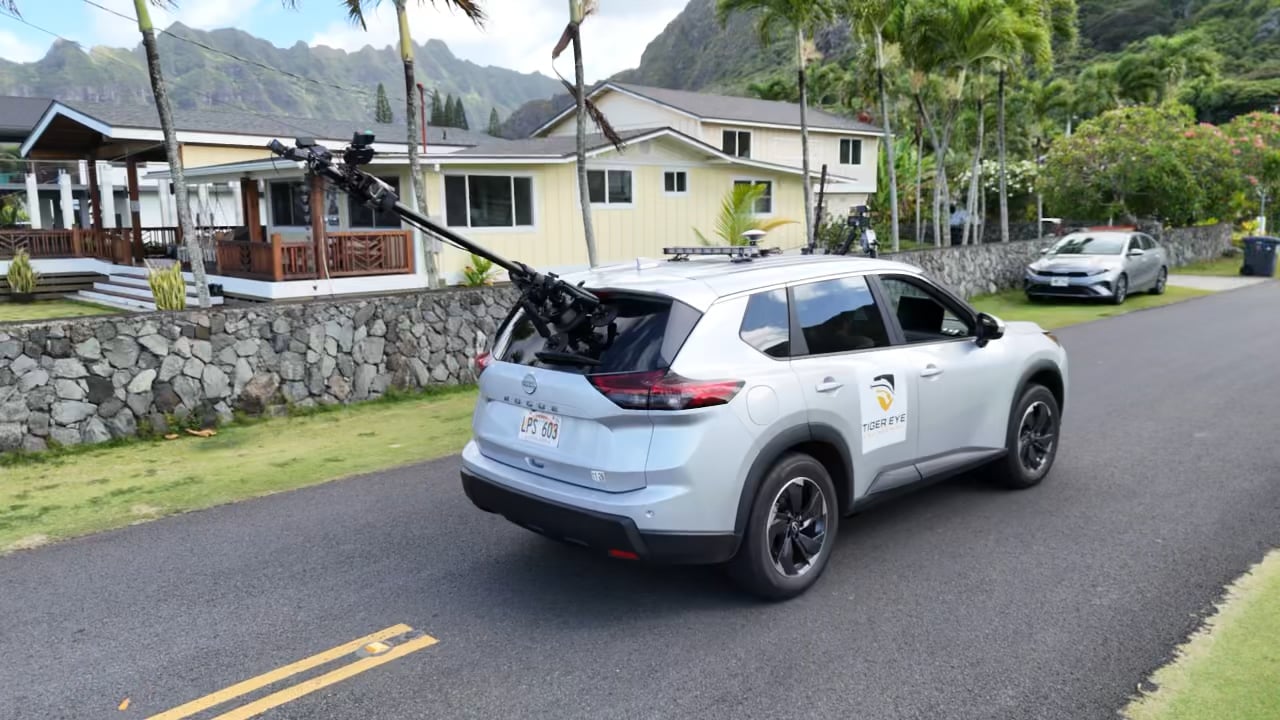

TEE provides transportation asset data collection, analysis, planning, and pavement management solutions powered by high-resolution imagery, LiDAR, AI-based detection systems, and advanced data visualization tools. Our vehicle-based sensor technology delivers accurate, objective insights for roads, sidewalks, signs, pavement markings, and other transportation assets. Combined with powerful web-based software, pavement management expertise, capital improvement planning support, and budget scenario modeling, TEE helps agencies make confident, data-driven infrastructure decisions.
Founded in 2021 by transportation engineering and data science experts from the University of Missouri, Tiger Eye Engineering (TEE) is transforming how agencies evaluate and manage infrastructure. Our innovative solutions combine AI-powered detection, high-resolution imagery, LiDAR technology, and advanced analytics to provide objective, accurate, and repeatable assessments of roads, sidewalks, pavement markings, signs, and other transportation assets.
From automated data collection to pavement management planning and interactive visualization dashboards, we help organizations optimize maintenance strategies, prioritize investments, and improve long-term infrastructure performance
✔ AI-Powered Analytics
✔ High-Resolution LiDAR Technology
✔ Advanced Data Visualization
✔ Transportation Asset Intelligence

Our vehicle-mounted sensor technology combines high-resolution cameras, LiDAR, GNSS receivers, and advanced onboard computing to collect comprehensive transportation asset data from a single survey.

Using machine learning and deep learning technologies, our AI automatically detects pavement distress, evaluates condition, and generates accurate Pavement Condition Index (PCI) ratings.

Create complete inventories of roadway assets including signs, pavement markings, guardrails, sidewalks, and right-of-way features using AI-powered detection and geospatial mapping.

Our mobile sensing platform analyzes sidewalks for accessibility issues, trip hazards, surface defects, and accessibility maintenance priorities through detailed 3D analysis.

Access interactive dashboards that combine maps, high-resolution imagery, pavement condition ratings, asset inventories, and 360° survey data for better infrastructure management.

Develop smarter pavement management programs through AI-powered assessments, budget scenario modeling, maintenance planning, and long-term capital improvement strategies.
TEE can measure rutting depth, surface geometry, and ride quality (IRI) with our LiDAR point-cloud - verified with inertial profiler data.


Partner with Tiger Eye Engineering to leverage AI-powered pavement assessment, transportation asset intelligence, and advanced data visualization for smarter infrastructure management.
We use cookies to analyze website traffic and optimize your website experience. By accepting our use of cookies, your data will be aggregated with all other user data.